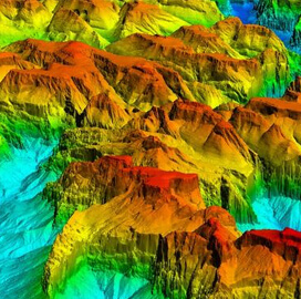
Woolpert will collect Quality Level 1 lidar data and perform ground control survey across Southern California under a $6.8 million task order from the U.S. Geological Survey.
The company said Wednesday the acquired aerial lidar data will support the 3D Elevation Program and contribute to the update and improvement of the National Map.
Known as 3DEP, the USGS National Geospatial Program-spearheaded initiative will provide the first baseline of high-resolution topographic elevation data that local, state and national agencies could use in their decision-making activities regarding security, environment and infrastructure. The data will also be added to the National Map.
Woolpert’s data collection effort will span Inyo County and parts of the Mojave Desert and Death Valley National Park. It will use a Leica TerrainMapper to collect 23,007 square miles of QL1 data at 8 points per square meter.
John Gerhard, vice president and program director at Woolpert, shared that the company has been supporting 3DEP since its launch.
“Critical decisions that depend on accurate and available elevation data are being made every day, and we are incredibly proud to continue our support for the U.S. Geological Survey and its commitment to completing the nation’s first-ever baseline of consistent high-resolution elevation data,” he added.
Data is anticipated by fall 2024.
According to Gerhard, Woolpert’s aerial lidar data collection effort will also support the 3D Hydrography Program, which seeks to remap the U.S. hydrography since the original USGS 1:24,000-scale topographic mapping program.


